
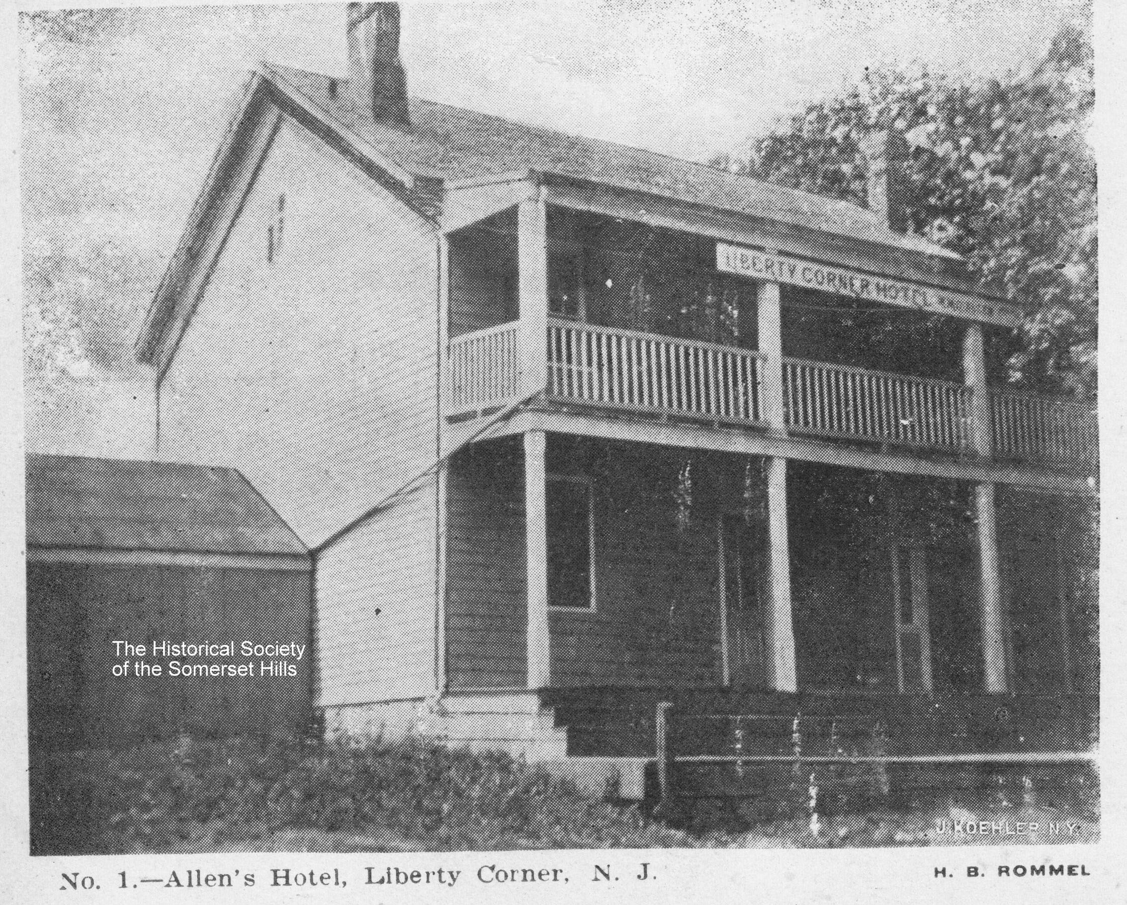
The Liberty Corner Hotel
This picture postcard shows Allen’s Hotel in Liberty Corner, NJ, which, based on the sign, was also known as the Liberty Corner Hotel. The card’s undivided back dates the photo to 1907 or before. The hotel occupied the corner where the Exxon station now stands and faced Valley Road. According to the 1850 Somerset County map
... Learn more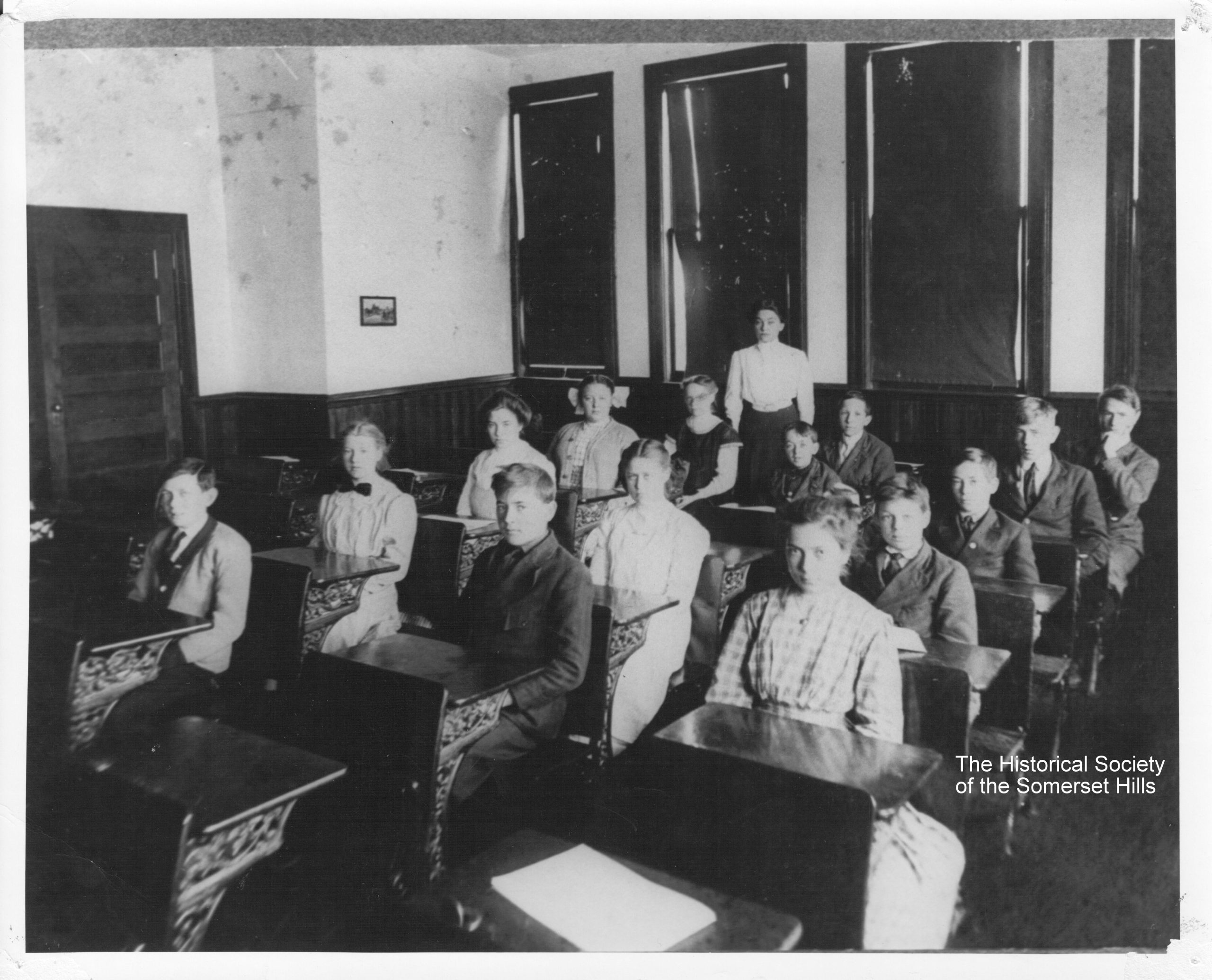
Maple Avenue School Class Photo
Sometime before 1980, Miss Mabel Clark shared this fantastic photo of herself in a class at Maple Avenue School in Basking Ridge, NJ (where the Bernards Township Library now stands). Not only does it provide close-ups of the faces, but the teacher and many students are identified. [on back]7th Grad, Maple Avenue School, 1914Teacher, Miss
... Learn more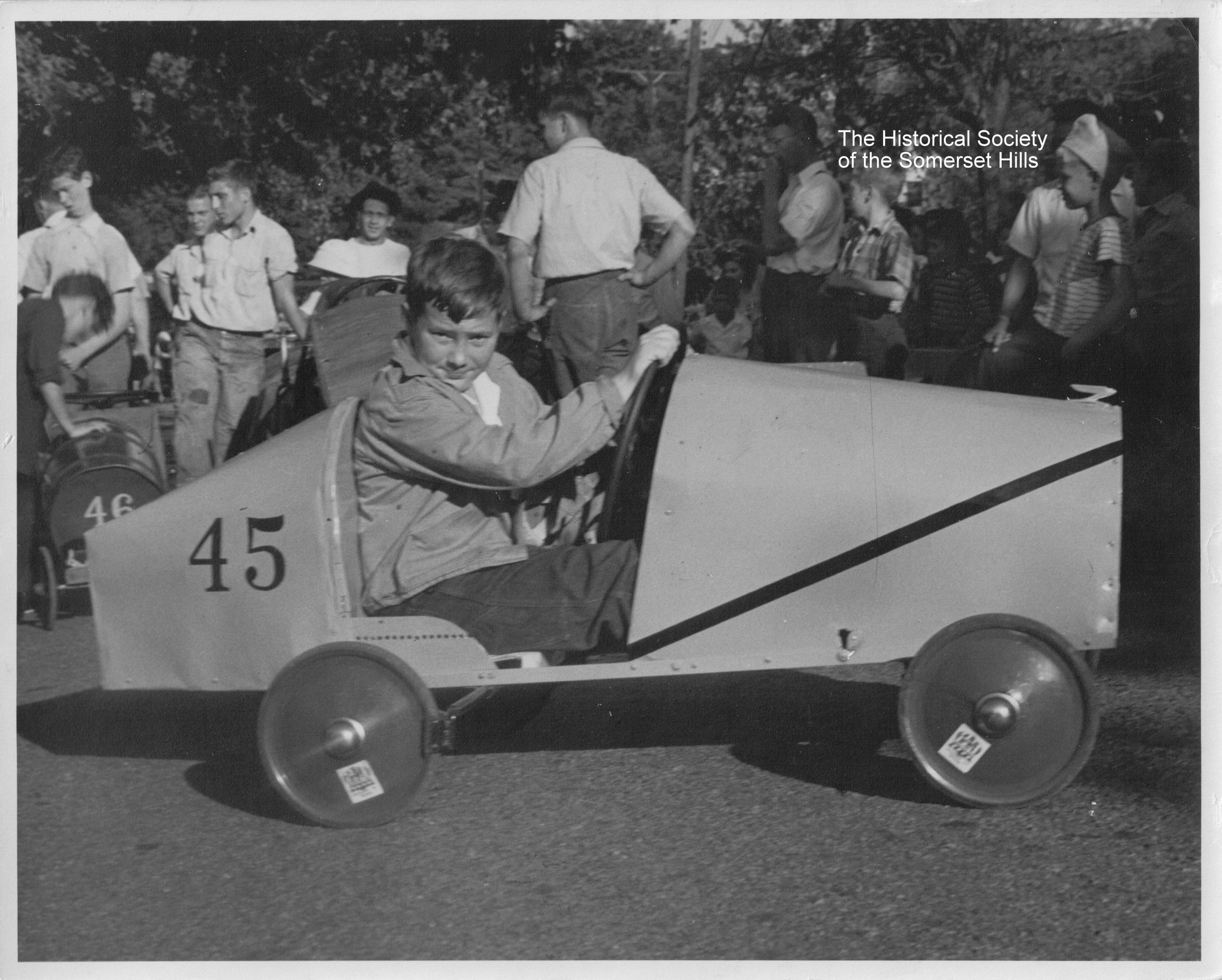
Peapack-Gladstone Soap Box Derby
After World War II, Soap Box derbies became a common form of family entertainment for many towns including Peapack-Gladstone and Bernardsville, NJ. The competition was open to youngsters, who constructed a “coaster car” powered by gravity. A standard kit provided the wheels and basic hardware. Ruth Hill Thomson, local historian and writer, collected a group
... Learn more
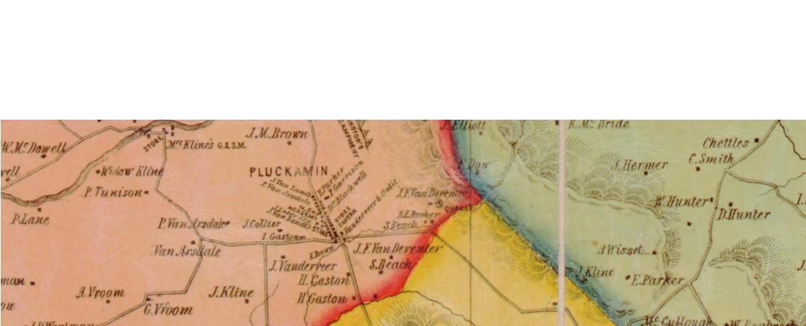
Olcott Avenue Quiz
After philanthropist Frederic P. Olcott died in 1909, many placenames in Bernardsville, NJ, were renamed in his honor, including Olcott Square, the Olcott building, and Olcott Avenue. Do you know what Olcott Avenue was called before it was renamed? For the answer, go to the THSSH Archives. Note, the archive document dates to 1914, when
... Learn more
THSSH May 2025 Newsletter
The May 2025 issue of the “Inside the Brick Academy” newsletter was mailed to THSSH members last week and is available online now. Read the full issue at: May 2025 Newsletter The cover announces the upcoming panel discussion on the March to Yorktown hosted at the Brick Academy by THSSH and the Washington-Rochambeau Revolutionary Route-New
... Learn more
Brick Academy Class Photo
This class photo from the Brick Academy in Basking Ridge, NJ, is interesting on several levels. Although faded, the photograph shows students and teachers from the 1890s when the Brick Academy was used as a Bernards Township public school. Today, when students from Bernards Township and Bernardsville visit the building on their class trips, they
... Learn more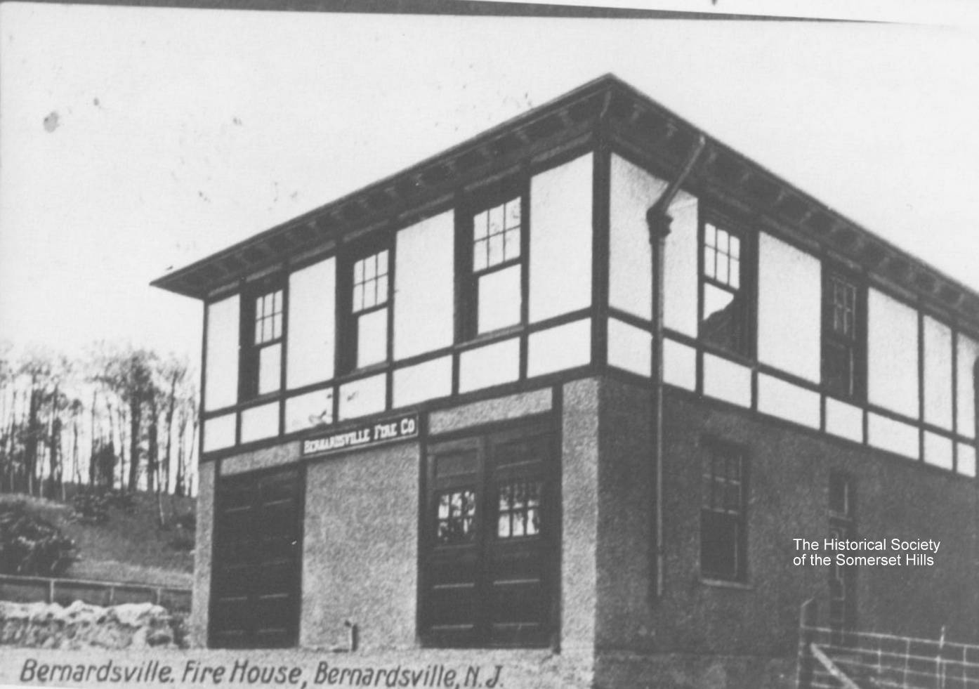
Bernardsville Firehouse – Then and Now
Next time you’re in downtown Bernardsville, NJ, take a look at 35 Mill Street. The building was built in 1906 as the new firehouse to replace the old one at 1 Anderson Road (site of the current Bernardsville Library). Frederic P. Olcott (1841-1909), Bernardsville’s great benefactor, donated funds to purchase the land. The real photo
... Learn more
Swaim Family Monument
If you run, bike, or walk your dog through Evergreen Cemetery in Basking Ridge, you may have noticed a large monument at the northern end near the railroad station. The Swaim family monument dwarfs its neighbors, including that of Ferdinand Van Dorn of Van Dorn’s Mill fame. Large monuments often tell interesting stories and the
... Learn more
Peapack-Gladstone Ambulance
The Peapack-Gladstone First Aid Squad received a new LaSalle ambulance in 1941. The Somerset Hills American Legion, Post 216, officially donated the vehicle at a dinner on March 31, 1941. The Basking Ridge Rescue Squad also acquired a LaSalle ambulance around this time. These acquisitions and coordination between area squads soon allowed Somerset Hospital in
... Learn more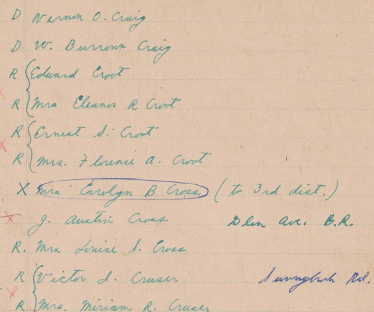
Bernards Township Voters’ Registers
The Historical Society of the Somerset Hills (THSSH) released a new searchable online collection—Bernards Township NJ Voters’ Registers. The documents cover the years 1905 (District 1), 1930 (District 2), and 1947-48 (Districts 1, 2, & 3). In many cases, the streets where the people lived are given and, in some cases, whether they were Republicans
... Learn more
My line is through their daughter Mary who married John Patrey, Jr.
What is your lineage from Jacob and Margaret? I descend from their son Peter.
Stephen Hunt is my 6th great grandfather and Margaret Hunt and Jacob Van Doren are my 5th great grandparents.
What an interesting article. I had no idea they had to do so much creative fundraising for the FD.
This article makes me so happy that the historical society was able to research this bottle that my Mother (Ingrid…