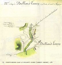
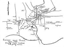
From the Volume set “The American Campaigns of Rochambeau’s Army 1780, 1781, 1782, 1783. Translated and Edited by Howard Rice and Anne Brown, Princeton University Press, Brown University Press, 1927
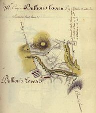
Map - Bullions Tavern aka Liberty Corner 1781
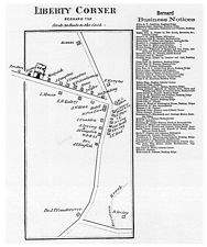
From the Volume set “The American Campaigns of Rochambeau’s Army 1780, 1781, 1782, 1783. Translated and Edited by Howard Rice and Anne Brown, Princeton University Press, Brown University Press, 1927
Map - Liberty Corner Village 1873
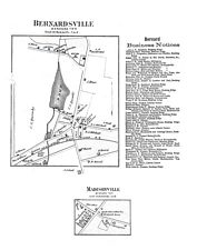
From the Atlas of Somerset County, New Jersey, published by Beers, Comstock & Cline, 36 Vesey Street, New York, 1873.
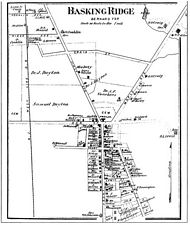
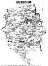
Map - Bernardsville & Madisonville 1873
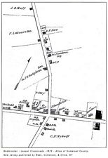
From the Atlas of Somerset County, New Jersey, published by Beers, Comstock & Cline, 36 Vesey Street, New York, 1873.
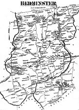
Map - Bedminster's Lesser Cross Road 1873
Bedminster 1873
From the Atlas of Somerset County, New Jersey, published by Beers, Comstock & Cline, 36 Vesey Street, New York, 1873.
Map - Pleasant Valley c.1880
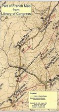
(W. Millington/Millington/Lyons-Bernards Township) what looks like the junction of Valley Road and Stonehouse Roads today (see Baptist Church icon)
Map - Greater Bernards Township c.1875
From the Atlas of Somerset County, New Jersey, published by Beers, Comstock & Cline, 36 Vesey Street, New York, 1873.
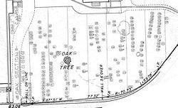
Map - Basking Ridge Presbyterian Church Graveyard
Basking Ridge Presbyterian Church Graveyard Map – Oak Tree Area
CementeryCemetery Burial Records/ Maps – Presbyterian Church, Basking Ridge
See if you have ancestors from the region. 700+ plot records!
Cemetery Records from the Basking Ridge Presbyterian Church
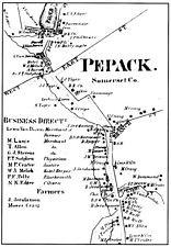
Map - Peapack Village c.1850
Then part of Bedminster.
From the Atlas of Somerset County, New Jersey, published by Beers, Comstock & Cline, 36 Vesey Street, New York, 1873.
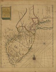
Map - Thortons of the East West Jersey Region c.1700
John Thornton’s massive atlas of maritime charts covering the entire nautical world. On this copper-engraved early English nautical chart includes soundings in New York harbor, Delaware Bay, and off shore. The diagonal lines are early colonial boundaries. The beautiful hand-colored outline and wash coloring is original.
North and South New Jersey (or East and West Jersey in colonial times) have always differed in some respect—geographically, politically. The northern areas were settled by the Dutch, and had a commercial focus strongly oriented toward the New York City market. The southern part of the state was settled by Swedes along the Delaware, and was a more rural farm-based economy linked to Philadelphia markets. The Dutch eventually took over the Swedish colonies, and those were subsequently taken by the English. The royal province of New Jersey was established by the English in 1702. During the American Revolution, New Jersey was a crossroads of conflict.